Maps
Not sure where to ride? There are tons of trail maps and apps available to help you find your way around Hochatown. From beginner loops to scenic forest rides, navigating the area has never been easier.

Avenza Maps
Download Avenza Maps to access official maps that highlight roads and trails that are open to UTVs, ATVs, and other offroad vehicles. This mapping tool works offline, no cell service is required!
Visit the App Store or the Google Play Store to download the app.

Forestry Service Map App
The Forestry Service map app is free and provides information on designated trails, boundaries, and closings.
Click the button below to view the map
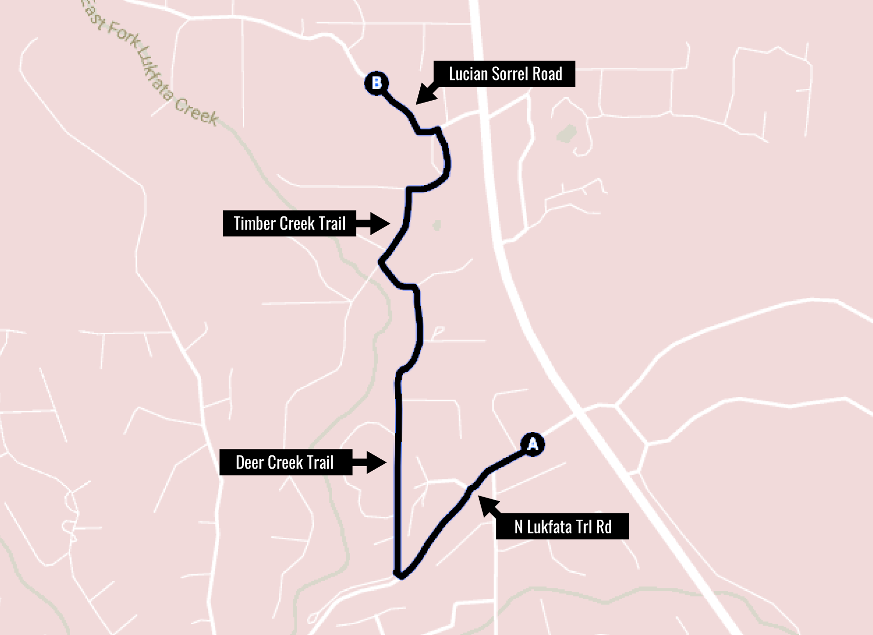
Directions from Mountain Fork Brewery to the UTV Trails
1. From Mountain Fork Brewery, take Lukfata Trail west.
2. Turn right onto Deer Creek Trail.
3. Continue on Deer Creek Trail until you reach Timber Creek Trail.
4. Turn right onto Timber Creek Trail.
5. Follow Timber Creek Trail until you reach Lucian Sorrel Road.
6. Turn left onto Lucian Sorrel Road – this road leads directly into the Forest Service roads and ATV trail access.


